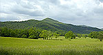
Crowned by craggy Appalachian peaks and shaded by verdant forest, Great Smoky Mountain National Park is an expansive playground for nature-lovers and outdoorsy types.
The walk along this trail to Benton Falls is well worth the effort. This trail also serves as a bicycle trail that joins the Clemmer Mountain Bike Trail. Benton Falls is 65 feet tall and is a wonderful sight to see.
Steepness: Much of the grail has grades of 20% or steeper. Length: Trails are usually more than 8 miles, but short, steep trails may be included. Surface: Trail is most likely rocky, with uneven footing. May include many stream crossings.
Details
Length:
1.5 miles
Difficulty:
Intermediate
Time:
1/2 to 1 hr
Season:
Spring to Fall
Additional Details:
The Chilhowee Recreation area offers camping, fishing, picnicking and swimming. There are also many hiking and biking trails that are located nearby. Contact the Ocoee/Hiwassee Ranger District for more information.
Site Information: Trail Number 131. Benton Falls Trail is blazed in blue.
Site Amenities: Parking available. This trail starts at Chilhowee Recreation Area. Picnic tables and bathrooms are available.
Safety: Watch out for poison ivy and snakes. Do not climb on the falls!!
We offer a compact version of Go-Tennessee for mobile users, allowing you to access just the information you need on the road. Of course, you can still use the full version of Go-Tennessee on your mobile device just as you can on your desktop.