Tennessee Map

go-tennessee.com

Our new sites are now in beta, tell us what you think

Pigeon Forge, Tennessee - Transportation

Maps, Directions, Airports, Rental Cars, Shuttles,...

Transportation information for Pigeon Forge is provided below. Travel information includes driving directions, maps, airport information and more.

Results


The McGhee Tyson Airport is located just south of Knoxville approximately 40 miles northwest of Pigeon Forge. Several airlines serve the airport such as Delta Air Lines, United Express, US Airways Express, and more offering flights to several major cities.

  • Transportation Services

Enterprise Rent-A-Car Save 50% on Weekends. Great Cars and Free Pick-Up. BOOK NOW! Enterprise Rent-A-Car offers great rates and great service. Choose from over 6,500 locations near your home, work or destination. Enterprise even offers vans and SUVs for that special trip.

Basic Directions

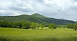
Pigeon Forge is located on the edge of the Great Smoky Mountains National Park, on Hwy. 321/441, about 45 minutes southeast of Knoxville.

Customizable Directions
From:    To: 
Language: 

Formatted DirectionsMap
Houseboating.org-Skyscraper-Tennessee

Email Page Link

Complete the form below to email this page to a friend or family member's email. You can send yourself an email as well. Your email and your recipient's email will NOT be shared with anyone. See our full Privacy Policy for details.
Your name:
Your email address:
Friend's email(s):


Send yourself a copy: Yes No
Subject:
Body: